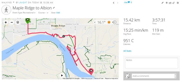
A team of 9 Loopers assembled at exactly 10:30 am at the corner of King Edwards Street and United Blvd. Everyone was eager to begin our Expedition to the Mighty Pitt, but waited patiently as the official photographer tried to prop up his cellphone for the starting selfie (a combination of the following were found to be effective: one water bottle; one guide book; an orange).
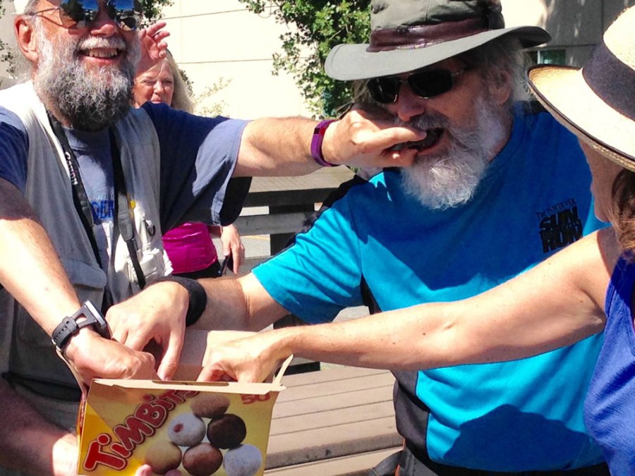
Fred took on the role of Squadron Leader, and he set a brisk pace along United Blvd, protected by an entourage of five female bodyguards: Joette, Janet S., Jean, Lise and Carol. Chris, Sandy and I opted for a more leisurely pace, while attempting to understand Fred’s mysterious power over women. From our vantage point at the rear we could properly appreciate the retail pleasures found in this lovely corner of suburbia (see the accompanying photos: Chris testing an attractive red Naugahyde couch; Sandy in front of his personal furniture store). No Timbits™ were consumed during this section of the walk (through several Loopers did investigate Tim Hortons’ washrooms).
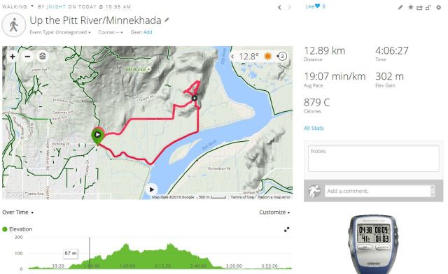
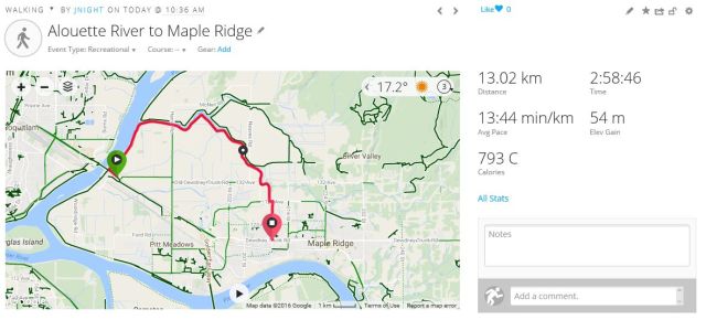
Benefitting from the lessons learned on last week’s expedition, we chose the scenic route alongside the river, and also took a short side trip to a small beach at the mouth of the Coquitlam River, where we chatted with two anglers who hoped to catch trout (one angler using what looked like a genuine Popeil Pocket Fisherman™). We offered to return for dinner (and were instructed to “bring some salt”); but later reneged.
En route, Fred bushwhacked to obtain samples of a tall wildflower just off the path, which Joette, our resident Master Gardener, later tentatively identified as “likely a Phlox” (to quote at greater length from her official botanical report: “There are a few problems with the idea of Phlox…from what I could see from my now wilted sample, our flower has four petals, while Phlox has five, and most varieties of Phlox have flower stems rising from a clump of leaves at the crown, whereas our plant has long, narrow leaves running up the stem. This is, however, like the cultivated Phlox.” So, TL;DR: likely a cultivated Phlox, living rough.)
Our lunch/snack break occurred when we located a suitable rock beside the path (some chose instead to scramble through underbrush to the river bank). We all agreed, later, that this site was vastly superior to the overly-neat grass, the too-attractive view of the river, and the unnecessarily-comfortable benches which we discovered just around the next bend in the path.
Passing the Gilnetter Pub we chose the pleasures of anticipation over the tawdry seductions of “a quick, cold one at the bar, standing up” (sorry Don). Our spirits, though, were soon lifted by the sight of a parking lot full of cherrypickers, with their arms upraised to the heavens in what looked like supplication. Later, at graveside, while overlooking the final bridge across the Mighty Pitt, we contemplated the mortality of dogs (RIP Mattie Pretty Lawson Keel, Dec 4, 2012 – July 20, 2015 “Only the good die young”). After the obligatory group selfie at the endpoint, we returned to the Gilnetter, and found it worthy of our earlier anticipations.

Starting group photo: winners at Winners

Chris considering the benefits of red Naugahyde

Sandy in front of his private furniture store

Something about chrysalises, and butterflies would be appropriate…

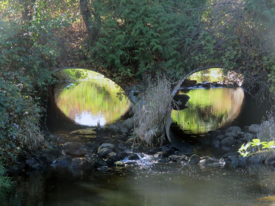
We consider the benefits of bridges…

…and the mightiness of rivers

Fred: bushwhacking

Joette: identifying

Janet S: official Phlox transporter

Carol: wading

Everyone (plus two bonus anglers): resting

Michael demonstrating proper stick usage with his shiney new walking stick

Port Mann Bridge resisting the river

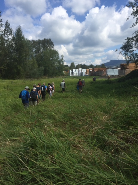
Onward, ever onward…

Preparing to cross the mighty Coquitlam

Sandy: navigating

Carol showing off her new Walking Stick Lite

The official lunch rock

Board walking

Waiting for the legendary “ghost ferry across the Pitt”

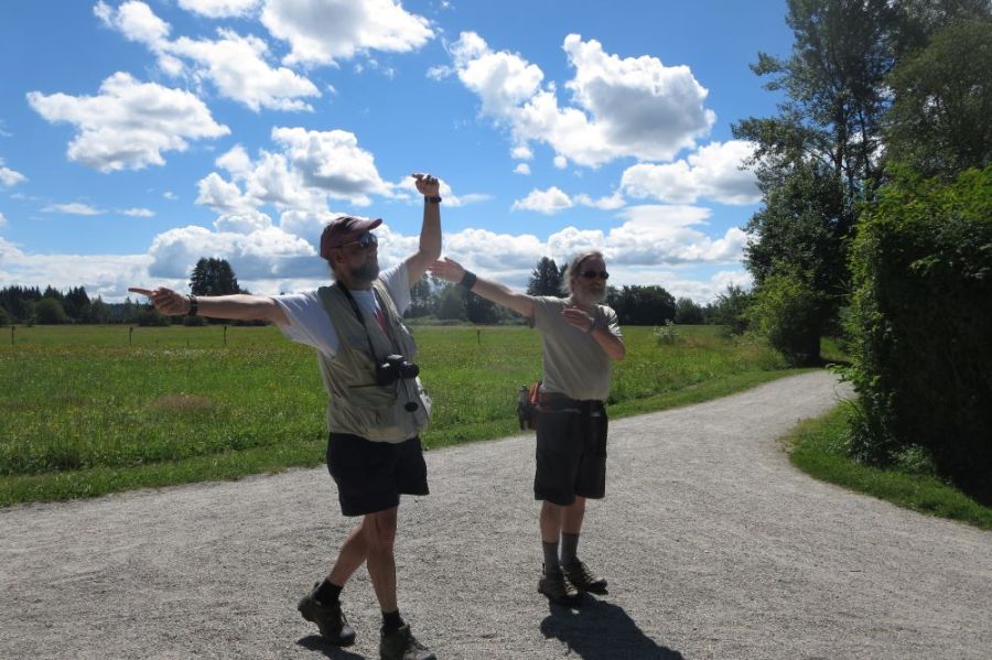
Drawn inexorably towards the cherrypickers

An uplifting sight

Two Loopers providing scale

Contemplating the mortality of dogs

The final stretch

And the final selfie…